-
Atlas of the World
Oxford University Press
Hardcover (Oxford University Press, Nov. 4, 2004)Eleven years ago, the first edition of Oxford's Atlas of the World was met with praise for the incredible beauty and accuracy of its maps as well as for its wealth of geographic data, and each successive edition only collects more accolades. The New York Times Book Review called it a "veritable encyclopedia of geographic and demographic information, profusely illustrated with multicolored maps and graphs," and the Baltimore Sun exclaimed that the newest edition was nothing less than "a magnificently produced example of quality publishing." Replete with 67 maps of cities worldwide, the 12th edition charts the key urban centers of each continent from Athens, Greece (including its new airport) to Wellington, New Zealand. As in past editions, the Atlas has been completely updated to reflect the changing world around us. Refined name forms in Malaysia and South Africa, the addition of a new state in Indonesia, extra name detail in the Atlantic and the Pacific Oceans and dozens of other improvements make this the most reliable atlas on the market. The unique Gazetteer of Countries adds a yet another quick reference tool to a book already teeming with useful information. Several new features further enhance the 12th edition. Interstate and state highways are now shown throughout North America, putting the overall precision and clarity of the book well ahead of the competition. A Glossary of Geographical Terms will be an enormous asset to those unfamiliar with foreign terminology while the colorful Introduction to World Geography--redesigned and beautifully illustrated with tables and graphs--provides informative summaries of topics as diverse as climate, global warming, plate tectonics, international conflicts, agriculture, trade, and population. What's more, detailed explanatory captions accompany the section of full-page satellite images that Library Journal called "stunning." Offering the finest global coverage available, the Atlas of the World sets the standard in atlas quality, living up to its reputation as an "indispensable reference," granted by NBC's Weekend Today Show.
-
Megan's Year: An Irish Traveler's Story
Gloria Whelan, Beth Peck
Hardcover (Sleeping Bear Press, Aug. 1, 2011)Through the voice of a young girl, the life of the people known as Irish Travelers is explored. Megan spends her summers traveling around the Irish countryside with her family. They move from place to place, hauling their camper behind their old car. But they aren't on vacation. This is their way of life. Megan and her family are Travelers. As part of their summer life, Megan's father works odd jobs, from fieldwork to roofing houses. Despite the rough living, Megan loves her life and the freedom that comes from traveling the open road. But at summer's end, when there's no more work to be had, the family moves to the city of Dublin. The camper is parked and they move into a cramped house. Megan and her siblings attend the local school as their parents struggle to make ends meet. And as the seasons pass, Megan counts down the days until she can return to her summer life. Gloria Whelan's other books in the Tales of the World series are Waiting for the Owl's Call, Yuki and the One Thousand Carriers (2008 Society of Illustrators Gold Medal winner), and Yatandou (a Junior Library Guild selection). Ms. Whelan lives in Michigan. Beth Peck earned a BFA from the Rhode Island School of Design and has illustrated many books for children, including A Christmas Memory, Just Like Josh Gibson, and Music for the End of Time. Ms. Peck lives in Menomonie, Wisconsin. N
N
-
World Atlas of Coffee
James Hoffmann
Hardcover (Mitchell Beazley, Oct. 6, 2014)Coffee has never been better, or more interesting, than it is today. Coffee producers have access to more varieties and techniques than ever before and we, as consumers, can share in that expertise to make sure the coffee we drink is the best we can find. Where coffee comes from, how it was harvested, the roasting process and the water used to make the brew are just a few of the factors that influence the taste of what we drink. Champion barista and coffee roaster James Hoffmann examines these key factors, looking at varieties of coffee, the influence of terroir, how it is harvested and processed, the roasting methods used, through to the way in which the beans are brewed. Country by country - from Bolivia to Zambia - he then identifies key characteristics and the methods that determine the quality of that country's output. Along the way we learn about everything from the development of the espresso machine, to why strength guides on supermarket coffee are really not good news. This is the first book to chart the coffee production of over 35 countries, encompassing knowledge never previously published outside the coffee industry. For everyone who wants to understand more about coffee and its wonderful nuances and possibilities, this is the book to have.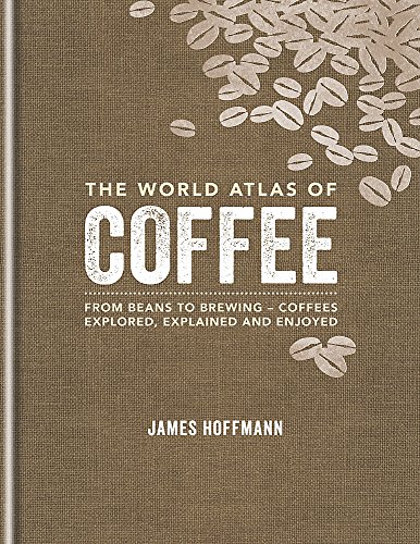
-
Atlas of the World
Oxford University Press
Hardcover (Oxford University Press, Nov. 1, 2017)The only world atlas updated annually, guaranteeing that users will find the most current geographic information, Oxford's Atlas of the World is the most authoritative atlas on the market. Full of crisp, clear cartography of urban areas and virtually uninhabited landscapes around the globe, the Atlas is filled with maps of cities and regions at carefully selected scales that give a striking view of the Earth's surface. It opens with a fascinating look at world statistics, a six-page special on "Land and Maritime Boudaries," and satellite images of earth, including 8-10 stunning new images sourced from NASA's latest Earth Observation Satellite, Landsat 8, launched in 2013. The extraordinarily extensive front matter continues with a "Gazetteer of Nations" that has been comprehensively checked and updated to include recent economic and political changes, and a 48-page "Introduction to World Geography," beautifully illustrated with tables and graphs on numerous topics of geographic significance, such as climate change, world religions, employment, industry, tourism, and travel. The hundreds of city and world maps that form the body of the Atlas have been thoroughly updated for this 24th edition.Providing the finest global coverage available, the Atlas of the World is not only the best-selling volume of its size and price, but also the benchmark by which all other atlases are measured.
-
Atlas of the World
Oxford University Press
Hardcover (Oxford University Press, Oct. 1, 2014)The only world atlas updated annually, guaranteeing that users will find the most current geographic information, Oxford's Atlas of the World is the most authoritative atlas on the market. Full of crisp, clear cartography of urban areas and virtually uninhabited landscapes around the globe, the Atlas is filled with maps of cities and regions at carefully selected scales that give a striking view of the Earth's surface. It opens with a fascinating look at world statistics, a six-page special on "The Future of the Oceans and Seas," and satellite images of earth, including eleven stunning new images sourced from NASA's latest Earth Observation Satellite, Landsat 8, launched in 2013. The extraordinarily extensive front matter continues with a "Gazetteer of Nations" that has been comprehensively checked and updated to include recent economic and political changes, and a 48-page "Introduction to World Geography," beautifully illustrated with tables and graphs on numerous topics of geographic significance, such as the geology and atmosphere of Earth, food and water supply, biodiversity, energy, global conflict, human health, and standards of living. The hundreds of city and world maps that form the body of the Atlas have been thoroughly updated for this 21st edition.Providing the finest global coverage available, the Atlas of the World is not only the best-selling volume of its size and price, but also the benchmark by which all other atlases are measured.New to this Edition:� Eleven stunning new satellite images, all sourced from NASA's latest Earth Observation Satellite, Landsat 8, launched in 2013� Fact panels, flags and text comprehensively checked and updated to include recent economic and political changes� Climate Change and Global Warming spread updated in line with findings from the Intergovernmental Panel on Climate Change� Updates to the depiction of the borders between Crimea and Ukraine, and between Crimea and Russia� Politically-colored maps of Crimea show disputed borders� New graphics on rising sea-levels and Arctic sea ice� New feature on the value of ecosystems� Adds museums; Hermitage, Spaarpotten, and Allard Pierson in Amsterdam, Bangkok Art and Culture Centre, Neues Museum in Berlin, Gulbenkian Museum in Lisbon, Design Museum and Saatchi Gallery in London, and the P�rez Art Museum in Miami� Adds new subway stations in Beijing, Budapest, and Delhi� Adds light railway in Jerusalem and tram route in Edinburgh� Renames Budapest International Airport� Shows changes to street names in Cape Town (eg Nelson Mandela Boulevard)� Adds new road tunnel in Istanbul joining Asia and Europe� Adds new suburb name Hudson Yards and High Line elevated garden in New York� Adds extra suburb names to Atlanta, Seoul, and Toronto� Shows new suburbs and areas of reclaimed land to Singapore� Shows Hornindalsvatnet in Norway, Europe's deepest lake� Adds new national parks; Sierra de Guadarrama in Spain, Gallipoli in Turkey, and Kumbhalgarh in Rajasthan, India� Shows reduced extent of Lake Urmia in Iran and Lake Razzaza in Iraq� Shows major new rail links between Iran and Kazakhstan and between Iran and Azerbaijan� Adds the world's most northerly railway line in the Yamal Peninsula, Russia� Adds Longtan Reservoir in Southern China and Tekeze Reservoir in Ethiopia� Shows new provinces; Monza and Brianza in Northern Italy, Davao Occidental in the Philippines, Kalimantan Utara in Indonesia, Rangpur in Bangladesh, Alborz in Iran, and Jiwaka and Hela in Papua New Guinea� Adds major new ports; Ambarli in Turkey, Songdo in South Korea, Laem Chabang in Thailand, Johor Port in Malaysia, Ra's Al Khair in Saudi Arabia, Morgan's Port in Texas, and Itaguai near Rio de Janeiro� Names new cities Iskandar, Malaysia and Masdar City, near Abu Dhabi� Adds new resorts in Southwest Burma - Chaungtha and Ngwesaung� Shows Telangana in regional type, pending ratification of statehood by Indian Congress� Adds new high speed rail lines under construction between Tel Aviv and Jerusalem, and between Rio de Janeiro and Sao Paulo� Shows rail under construction between Kaduna and Abuja, Nigeria� Shows new administrative subdivisions in Oman, Kenya, Tanzania, Namibia, and Madagascar� Shows major ore exporting ports; Cape Lambert in Western Australia and Puerto Bolivar in Colombia� Shows new heights for Aoraki Mount Cook and Mount McKinley (Denali)� Names world's largest extinct volcano the Tamu Massif, Northwest Pacific� Adds regional names Kitikmeot, Kivalliq, Nunavik, and Nunatsiavut in Northern Canada� Shows Algodones Dunes in Southern California
-
Atlas of the World
Oxford University Press
Hardcover (Oxford University Press, Oct. 1, 2016)The only world atlas updated annually, guaranteeing that users will find the most current geographic information, Oxford's Atlas of the World is the most authoritative atlas on the market. Full of crisp, clear cartography of urban areas and virtually uninhabited landscapes around the globe, the Atlas is filled with maps of cities and regions at carefully selected scales that give a striking view of the Earth's surface. It opens with a fascinating look at world statistics and 18 pages of stunning satellite images, all sourced from NASA's latest Earth Observation Satellite, Landsat 8. The extraordinarily extensive front matter continues with a "Gazetteer of Nations" that has been comprehensively checked and updated to include recent economic and political changes, and a 48-page "Introduction to World Geography," beautifully illustrated with tables and graphs on numerous topics of geographic significance, such as the geology and atmosphere of Earth, food and water supply, biodiversity, energy, global conflict, human health, and standards of living. The hundreds of city and world maps that form the body of the Atlas have been thoroughly updated for this 23rd edition.Providing the finest global coverage available, the Atlas of the World is not only the best-selling volume of its size and price, but also the benchmark by which all other atlases are measured.
-
Atlas of Africa
Rusty Campbell, Malcolm Porter, Keith Lye
Library Binding (Rosen Pub Group, Jan. 1, 2010)This colorful atlas utilizes maps, pictures, flags, globe panoramas, information panels, diagrams, and charts to give an overview of the entire continent of Africa, along with a close-up view of its countries. Information doesnt stop therereaders learn about the history, peoples, wildlife, languages, currency, and government of each country. Readers learn about groundnuts in Gambia and Senegal, and ostrich farms in South Africa. The book also contains a map showing pre-colonial events and areas of recent conflict. A timeline of important dates appears in the politics and history section. R
R
-
Atlas of the World
Oxford University Press
Hardcover (Oxford University Press, Oct. 1, 2009)The only world atlas updated annually, guaranteeing that users will find the most current geographic information, Oxford's Atlas of the World is the most authoritative resource on the market. The Sixteenth Edition remains the finest international reference source of its kind available. Including new census information, dozens of city maps, gorgeous satellite images of Earth, and a geographical glossary, this atlas offers exceptional value at a reasonable price. Full of crisp, clear cartography of urban areas and virtually uninhabited landscapes around the globe, the Atlas has maps of 69 cities and nearly 100 different regions at carefully selected scales that give a striking view of the Earth's surface. Opening with world statistics and a colorful, instructive 48-page Introduction to World Geography--beautifully illustrated with tables and graphs--this acclaimed resource provides details on such topics as climate, the greenhouse effect, plate tectonics, agriculture, population and migration, and global conflicts. As in years past, this edition includes the latest geographic information. The popular satellite image section has been refreshed with stunning new images of different regions and urban areas. A completely updated Gazetteer of Nations provides an invaluable A-Z reference of concise country profiles, including statistics on economies, politics, and historical profiles. Providing the finest global coverage available, the Atlas of the World is not only the best-selling volume of its size and price, but also the benchmark by which all other atlases are measured. · Interior pages designed for heightened accuracy and ease of use · Detailed city plans and country profiles make it the ultimate geographic reference The Design Oxford's Atlas of the World is a sturdy, high-quality, large-format book that is filled with crisp cartography, spectacular satellite imagery, and a wealth of information on changing conditions around the planet. The Special Sections Oxford's Atlas of the World provides an extensive intro to World Geography, up-to-date information on current events of geographical significance, captioned satellite images of the Earth, facts and figures on every sovereign state, and detailed coverage of 69 major urban areas. The Quality of Information Oxford's Atlas of the World is the only world atlas that is updated annually, guaranteeing that users will find the most current geographic information. It is the most authoritative resource on the market and offers the most current global information available today through a combination of statistics, maps, and photographs. The History Oxford University Press is known around the world for excellence, tradition, and innovation. The Atlas of the World is the best-selling volume of its size and price and the esteemed benchmark by which all other atlases are measured. The Price You receive a lavish, top-quality product at an excellent price that is comparable or lower than the main competitors.
-
Yuki and the One Thousand Carriers
Gloria Whelan, Yan Nascimbene
Hardcover (Sleeping Bear Press, April 5, 2008)In the seventeenth and eighteenth centuries, Japanese provincial governors had to travel between the cities of Kyoto and Edo (modern-day Tokyo). This 300+ mile journey on the historic Tokaido Road required the presence of one to three thousand attendants (carriers). Yuki's father has been called to Edo and she, along with her mother and pet dog, must accompany him in this royal procession. Yuki does not want to go. She will miss her home and her teacher. But she must not be disrespectful so Yuki captures her thoughts in haiku, a Japanese form of poetry. Once outside the gate How will I find my way back? Will home disappear? Inspired by the woodcuts of Japanese printmaker, Hiroshige, award-winning author Gloria Whelan brings a cultural event to life through the observant eyes and thoughtful verses of a young Japanese girl. Gloria Whelan's many award-winning books include Homeless Bird for which she received the National Book Award. Her work with Sleeping Bear Press includes Yatandou and Mackinac Bridge: The Five-Mile Poem (a 2007 Michigan Notable Book). Ms. Whelan lives in Grosse Pointe Woods, Michigan. Yan Nascimbene studied at the School of Visual Arts in New York and at the University of California at Davis. His work has appeared in numerous publications including TIME. He has illustrated over 50 books, including Hachiko: The True Story of a Loyal Dog. Yan twice received the Society of Illustrators' Silver Medal and many other awards. He lives in Provence, in the village of Cotignac. N
N
-
Atlas of Asia
Rusty Campbell, Malcolm Porter, Keith Lye
Library Binding (Rosen Pub Group, Jan. 15, 2010)This amazing book combines attractive maps and pictures, flags, globes, information panels, diagrams, and charts to give an overview of the entire continent of Asia, with country close-ups included. Readers will also be learning about famous people, animals, plants, places, and products. The Great Wall of China, the Petronas Towers in Kuala Lumpur, the Trans-Siberian Railway, Petra, Ur, the Taj Mahal, Mount Fuji, and Angkor Wat are among the many places discussed. The politics and history section includes a timeline of significant dates in Asia's history. R
R
-
Tuki and Moka: A Tale of Two Tamarins
Judy Young, Jim Madsen
Hardcover (Sleeping Bear Press, Aug. 1, 2013)Eduardo and his family live in a small town in Ecuador, not far from the Amazon rainforest. The rainforest is an important part of their lives. Each month Eduardo and his father travel by river from their town to the rainforest. There, using just a basket and a machete, they gather Brazil nuts. They are castañeros and this is how they earn their living. But the rainforest is not only important to the castañeros; it is home to many exotic species of plants, birds, and mammals, including two playful tamarins that Eduardo has named Tuki and Moka. So although it is difficult work being a castañero, Eduardo looks forward to his visits to the rainforest so he can play with his two friends. But one night, the peace of the forest is threatened by poachers, animal traffickers who illegally capture and then try to sell some of the birds and animals. Can Eduardo save his friends? L
L
-
The Boy Who Wanted to Cook
Gloria Whelan, Steve Adams
Hardcover (Sleeping Bear Press, Sept. 9, 2011)La Bonne Vache (The Good Cow) is a little restaurant in the south of France. It takes its name from and is famous for its boeuf à la mode, a delicious beef stew. Ten-year-old Pierre longs to follow in the culinary footsteps of his father, Monsieur Valcourt. Monsieur Valcourt is the chef and owner of La Bonne Vache. Pierre spends as much time as possible in the restaurant's kitchen, hoping for a chance to demonstrate his cooking skills. But his parents shoo him away and he is not allowed to cook. One day Pierre meets a visitor who is on his way to eat at the restaurant. This is no ordinary visitor but an important food critic. His experience at La Bonne Vache could bring great honor to the restaurant. At last, Pierre sees his chance to prove himself. Award-winning author Gloria Whelan received the National Book Award for her young adult novel, Homeless Bird. Her books with Sleeping Bear Press include The Listeners, Friend on Freedom River, and Jam and Jelly with Holly and Nellie. She lives in Michigan. N
N